Tuesday, September 11, 2007

Fargo-North Dakota

Last week, I spent 3 days working in Fargo North Dakota. I was very busy the entire time I was there, but I was able to see a few sites. Fargo is on the border between North Dakota and Minnesota. The Red River runs through the center of town. The river is also the state border line. The town on the North Dakota side is Fargo. The portion of town on the Minnesota side is named Moorhead.

One thing Fargo is well know for is the fact that the famous baseball player Roger Maris grew up in the Fargo area. Roger Maris was the first player to break Babe Ruth's single season homerun record of 60. He hit 61 home runs in 1961 while playing for the New York Yankees.

He was born across the border in Minnesota, but his family moved to Fargo where Roger spent his school years. He was active in school sports and later started his professional baseball career by playing for one of the Minnestoa farm teams in Fargo. They have a Roger Maris Museum inside the Fargo Mall. I visited the museum and took some pictures that are below (you can click on many of the pictures below to see a larger version).


There are 61 banners hanging from the ceiling along the edge of the display cases with one banner for each homerun that he hit on the way to the record. The date and location of each of his 61 home runs is displayed on the banners.


They have lots of trophies and memorabilia from Roger's career. Including many of the bats and balls from his many homeruns. Here is a close-up pic of some of the items:


One interesting fact about Roger Maris is that he has still not been selected for membership into the Baseball Hall of Fame. There has been much controversy over the years about this, but so far he has not been selected.

They even had a minature replica of Roger Maris' gravestone (see below). He is buried in a Fargo cemetery


Also, I did a lot of driving around the eastern North Dakota countryside from Fargo up to Grand Forks. It is very flat terrain with many large wide open farm fields. I saw fields of corn, soybeans, and even sunflowers. Some of the fields were so large that you could not even see the other ends of the rows. There were many small towns. Many of them might only have some grain silos, a store, and about 10 houses.

There are many native American Indian tribes in the area. Some of the town names are old Indian names too. Here is a picture of one of the state road signs that showed a picture of an Indian chief along with the road number.


Monday, August 20, 2007

Lake Superior- Noth Shore

This evening I took a drive up the scenic higway along the north shore of Lake Superior. There are some nice views on the road there. They call highway 61 their scenic drive route. There are lots of rental cabins, hotels, lodges, small towns with crafts, etc. The landscape is very rocky in many places. Sometimes the road varies from lake level up to a few hundred feet above the lake. The road has overlook parking lots at regualr intervals.

Here are a few pics from some of the overlooks.


There are also road tunnels thru some of the larger hills like the one below.


There is also a bike/hiking trail that runs alongside the road and the lake most of the way to Canada. It is called the Gitchi Gami State Trail.


There is a great water fall along the trail from the Gooseberry River (called Gooseberry Falls). There is an Upper, Middle, and Lower falls. I visited the middle and lower falls at the Gooseberry State Park. Here are some pics from the park and the middle falls.


Here's a close up shot of the lower falls.


There are lots of exposed lava rocks in the area. The river has eroded the rock in many areas. Here are some pics of the lava rock in the river and above it.


Here's a picture of an interesting tree root growing in the rocks beside the river.


Here's another picture of an interesting tree that was hollow and twisted but it was still thriving.


Farther up the lake coast drive, there is a major attraction called the Split Rock Lighthouse. It sits up on a rocky hill directly on the coast in another state park. I tried to get to it, but I was too late. It was closed when I got there. However, I did barely get the following picture (just before dark) from one of the overlooks. You can just barely see the lighthouse way off in the distance in the middle of the picture.


And here's a picture from a brochure I picked up that shows a close up of the lighthouse.

Cloquet/Duluth-Minnesota

I've been working in Minnesota ("Land of 10,000 Lakes") for the last few days. the temperature here is much cooler than North Carolina. I don't think the temp has gotten over 78 degrees in the 3 days I have been here. Yesterday the high was barely 70 and the low was 52 !!!
We worked long hours the first couple of days, but yesterday I got the chance to visit the Jay Cooke State Park. The park is only about 5 miles from my hotel. The park is on the St.Louis River between Cloquet and Duluth Minnestoa. (at the tip of Lake Superior). Here is the sign at the main entrance (the orange barrell was due to road construction at the entrance):


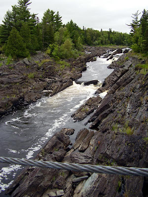
The park's main feature is the gorge that the river has cut through the slate rock. It made for a few interesting small warterfalls. They also have a swinging bridge over the river gorge. The original bridge was built in 1924 of logs and planks. It was washed away during an unusually high river in 1950. The current bridge was rebuilt in 1953. Here a few pics from my vist to the swinging bridge there. The wind was gusting up to around 30 miles per hour and it was only in the 50's at the time of these pics. So, it felt very chilly.


Here's a sign that was posted to show a picture of the original bridge being washed away by the river in 1950:


The river below has some small water falls. Here are some pics of the river below and the waterfalls.


I hiked the short trail to the top of the largest falls on the other side of the river. Here's a couple of pics from the top of those falls.


Bye,
Glenn

Wednesday, August 1, 2007

Jim Beam Distillery tour

I had a little more free time today.


So, I had to visit a place that Kentucky is known around the world for . . . Bourbon. I toured the Jim Beam Distillery in Clermont, Kentucky. Here are some pics I took at the distillery.

This first picture is the road side sign at the entrance.


They had a building called the American Outpost that was a combination vistor center, gift shop, museum, and auditorium. They had various artifacts and some displays that showed the distillation process. They also showed a 13 minute movie about the history of the Beam family and the bourbon production process. There are actually laws governing the production of bourbon such as alcohol strength (proof), aging process, and flavor. The Beam family started producing their first Bourbon for sale in 1795. Bourbon became very popular and was even used as payment/currency by many persons. In fact, Abraham Lincoln's father sold his original farm where Abraham Lincoln was born for the sum of $20 and 20 barrels of bourbon. He could use the bourbon to buy other things he needed.


After distillation, the bourbon is placed into the oak barrels like the one pictured here for the aging process. The barrels hold 53 gallons of bourbon.


The barrels are actually burned/scorched on the insides to help flavor the bourbon while it is stored.


When the bourbon is first distilled it is actually clear. After aging in the barrels for several years, the bourbon takes on the golden brown color that is normally seen on the bottles on the shelf.
The oak barrels actually give the bourbon it's color and much of it's flavor.


The aging takes from 4 to 9 years or more depending on the grade of the bourbon. The barrels are stored for aging in many warehouses on the Beam property.
This picture is one of those warehouses.


Here's some pictures of the barrels aging inside this warehouse.


The plaque below was displayed on the front of this warehouse.
Barrels can only be used once for bourbon production. The production of the barrels became a big business. The building where they were produced was called a Cooper Shop.
Here's a picture of a Cooper Shop that has been restored at the Beam property.


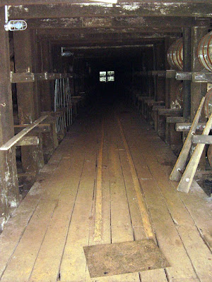
The following pictures are inside the Cooper shop showing the various tools and processes used to produce the barrels.


This picture is of the Jim Beam fire truck restored and on display at the property.


This picture is the house where many of the Beam family members have lived.
We were invited in to tour the downstairs of the house and were offered a free sample of some of the Beam's bourbon. On the day I visited, we were served the BOOKER brand of bourbon. This was one of the older smaller batch bourbons produced by the Beam family.


Bye,
GLENN

Tuesday, July 31, 2007

Fort Knox-Kentucky

Today, I visited the General Patton Museum at Fort Knox Kentucky. I am posting a few pictures here. Have a look. . .

The first two pictures are some of the armored vehicles (tanks, etc.) that are displayed in the park outside the museum.

Of course, the second pic is of the entrance to the museum.


The third pic is General Patton's touring car. He died in a non-combat car accident in France (?) in December of 1945 after the war was over. The front end of the car was damaged severly in the accident but it was restored for display in the museum. They had lots of other artifacts that belonged to him on display in the museum. They also had a good 30 minute film about Patton's life and career.


The next pic is another tank that was on display inside the museum. They had lots of armored vehicles on display from many different countries.


The last picture is a quick photo of the US Gold Bullion Repository at Fort Knox. They don't give tours of this place (understandably), but I took this picture as I was riding along the highway beside it.

Bye,
GLENN